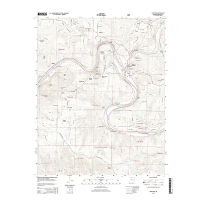
2014 Map of Norfork
USGS Topo · Published 2014About this map
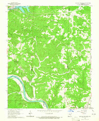
Norfork sits at the significant confluence of the North Fork River and the White River, a location that historically anchored river traffic in the Ozarks. This 2014 survey details a landscape where steep bluffs and hollows define the movement of people and water. The town of Norfork is surrounded by high terrain, including Matney Knob with its Matney Knob Lookout Tower and Wild Hog Mtn. The map reveals a cluster of smaller settlements and rural hubs such as Arkana, Salesville, Lone Rock, and Herron. Genealogists will find several burial sites preserved here, including Arkana Cem, Norfork Cem, and the descriptively named Burnt Sch House Cem. Within the Ozark National Forest, landmarks like Red Bluff and White Bluff tower over the river bends, while local education history is marked at the Martin Springs Sch.
Find a feature on this map
118 named features on this map. Tap any name to fly to it.
Don’t see what you’re looking for? This feature index may not catch every label — zoom into the map to look around manually.
Map Details
Editions of this 2014 Norfork Map
This is the sole edition of this map. No revisions or reprints were ever made.
Other maps of this area
1890 · Mountain Home
USGS Topo · 1:125,000
1891 · Mountain Home
USGS Topo · 1:125,000
1894 · Mountain Home
USGS Topo · 1:125,000

1945 · Harrison
USGS Topo · 1:250,000

1949 · Harrison
USGS Topo · 1:250,000
1954 · Harrison
USGS Topo · 1:250,000
1958 · Harrison
USGS Topo · 1:250,000
1964 · Harrison
USGS Topo · 1:250,000
1964 · Calico Rock
USGS Topo · 1:24,000
1964 · Norfork Dam South
USGS Topo · 1:24,000