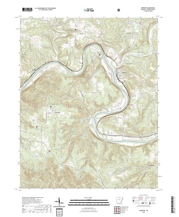
2024 Map of Norfork
USGS Topo · Published 2024About this map
The confluence of the North Fork River and the White River anchors this study of Baxter County, where the settlement of Norfork sits at the water's edge. The landscape is defined by its dramatic elevation changes, from the heights of Wild Hog Mtn and Matney Knob to the deep incisions of Ellen Cockran Hollow and Rough Hollow. This modern survey illustrates the enduring rural character of the region, where family and community heritage is preserved in sites like the Burnt School House Cem and Arkana Cem. Much of the southern terrain is protected within the Ozark National Forest and the Leatherwood Wilderness, limiting modern development to the corridors along Goat Ridge and the various county roads. The importance of the river system is evident in the winding path of Shipps Ferry Rd and the prominent limestone features such as White Bluff, which overlook the twisting river bends.
Find a feature on this map
134 named features on this map. Tap any name to fly to it.
Don’t see what you’re looking for? This feature index may not catch every label — zoom into the map to look around manually.
Map Details
Editions of this 2024 Norfork Map
This is the sole edition of this map. No revisions or reprints were ever made.
Other maps of this area

1890 · Mountain Home
USGS Topo · 1:125,000

1891 · Mountain Home
USGS Topo · 1:125,000

1894 · Mountain Home
USGS Topo · 1:125,000

1945 · Harrison
USGS Topo · 1:250,000

1949 · Harrison
USGS Topo · 1:250,000

1954 · Harrison
USGS Topo · 1:250,000

1958 · Harrison
USGS Topo · 1:250,000

1964 · Harrison
USGS Topo · 1:250,000
1964 · Calico Rock
USGS Topo · 1:24,000
1964 · Norfork Dam South
USGS Topo · 1:24,000