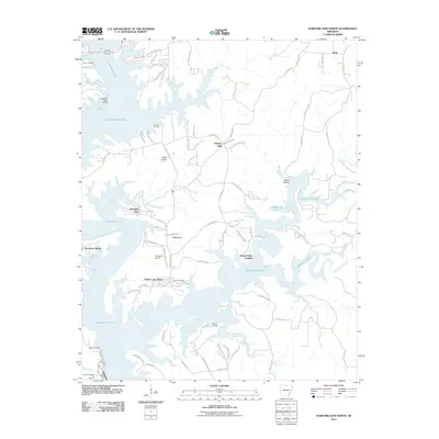
2011 Map of Norfork Dam North
USGS Topo · Published 2011About this map
Norfork Lake dominates the landscape of north-central Arkansas in this 2011 survey, its deeply indented shoreline creating a network of peninsulas and sheltered coves. The area is characterized by numerous landings and small settlements that cater to the lake’s recreational and residential character, including Diamond Bay, Holiday Hills, and Timber Lake Manor. At the southern edge of the sheet, the Norfork Dam regulates the water, flanked by the Norfork National Fish Hatchery and Quarry Landing.
Find a feature on this map
85 named features on this map. Tap any name to fly to it.
Don’t see what you’re looking for? This feature index may not catch every label — zoom into the map to look around manually.
Map Details
Editions of this 2011 Norfork Dam North Map
This is the sole edition of this map. No revisions or reprints were ever made.
Other maps of this area

1890 · Mountain Home
USGS Topo · 1:125,000

1891 · Mountain Home
USGS Topo · 1:125,000

1894 · Mountain Home
USGS Topo · 1:125,000

1945 · Harrison
USGS Topo · 1:250,000

1949 · Harrison
USGS Topo · 1:250,000

1954 · Harrison
USGS Topo · 1:250,000

1958 · Harrison
USGS Topo · 1:250,000

1964 · Harrison
USGS Topo · 1:250,000
1964 · Pineville
USGS Topo · 1:24,000
1964 · Norfork Dam South
USGS Topo · 1:24,000