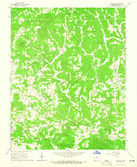
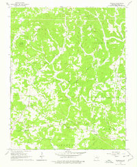
1964 Map of Pineville
USGS Topo · Published 1965About this map
The high ridges and deep hollows of Izard County are meticulously documented in this mid-1960s survey, showing a landscape defined by small upland settlements and the winding paths of Piney Creek and Brushy Creek. The community of Pineville serves as a central hub, connected to outlying points like Dolph and Crossroads by a network of winding local roads. This era of the Ozarks is marked by its numerous rural congregations and family burial grounds, including Campgrounds Ch and the Cresswell Cem.
Find a feature on this map
32 named features on this map. Tap any name to fly to it.
Don’t see what you’re looking for? This feature index may not catch every label — zoom into the map to look around manually.
Map Details
Editions of this 1964 Pineville Map
2 editions found
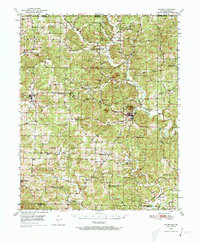
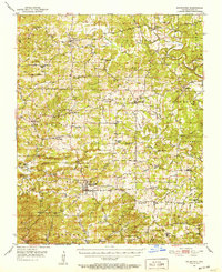
Other maps of this area

1890 · Mountain Home
USGS Topo · 1:125,000

1891 · Mountain Home
USGS Topo · 1:125,000

1894 · Mountain Home
USGS Topo · 1:125,000

1945 · Harrison
USGS Topo · 1:250,000

1949 · Harrison
USGS Topo · 1:250,000
1950 · Salem
USGS Topo · 1:62,500

1951 · Salem
USGS Topo · 1:62,500
1951 · Melbourne
USGS Topo · 1:62,500

1954 · Harrison
USGS Topo · 1:250,000

1957 · Poplar Bluff
USGS Topo · 1:250,000