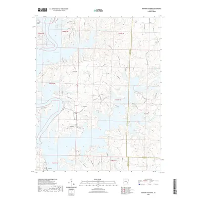
2020 Map of Norfork Dam North
USGS Topo · Published 2020About this map
Norfork Lake dominates this northern Arkansas landscape, its intricate, branching fingers reaching into the valleys of the Ozark foothills. The massive impoundment, held back by the Norfork Dam, has transformed the area's geography, creating miles of shoreline and numerous inlets such as Eagle Point Cove and Boggy Landing Cove. High points like Flint Knob and Wolf Knob stand as sentinels over the water, providing topographical relief in a region defined by its narrow ridges and steep hollows.
Find a feature on this map
84 named features on this map. Tap any name to fly to it.
Don’t see what you’re looking for? This feature index may not catch every label — zoom into the map to look around manually.
Map Details
Editions of this 2020 Norfork Dam North Map
This is the sole edition of this map. No revisions or reprints were ever made.
Other maps of this area

1890 · Mountain Home
USGS Topo · 1:125,000

1891 · Mountain Home
USGS Topo · 1:125,000

1894 · Mountain Home
USGS Topo · 1:125,000

1945 · Harrison
USGS Topo · 1:250,000

1949 · Harrison
USGS Topo · 1:250,000

1954 · Harrison
USGS Topo · 1:250,000

1958 · Harrison
USGS Topo · 1:250,000

1964 · Harrison
USGS Topo · 1:250,000
1964 · Pineville
USGS Topo · 1:24,000
1964 · Norfork Dam South
USGS Topo · 1:24,000