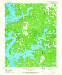
1965 Map of Norfork Dam North
USGS Topo · Published 1967About this map
Norfork Lake dominates this mid-1960s landscape, its sprawling fingers reaching into the rugged Ozark terrain of North Central Arkansas. At the southern edge, the massive Norfork Dam regulates the water, flanked by a Fish Hatchery and several designated picnic areas. This survey captures a transitional period of recreational development, evidenced by a series of specialized access points including the Kirkview Landing Strip and Diamond Bay Landing Strip, alongside traditional water access at Salem Landing and Newton Landing. Away from the shoreline, the map reveals established rural communities and landmarks like Henderson and the high point of Flint Knob. Local spiritual life is marked by the Wates Ch and Center Point Ch, while the industrial presence of a Quarry near the northern border points to the area's resource extraction history.
Find a feature on this map
37 named features on this map. Tap any name to fly to it.
Don’t see what you’re looking for? This feature index may not catch every label — zoom into the map to look around manually.
Map Details
Editions of this 1965 Norfork Dam North Map
2 editions found
Other maps of this area

1890 · Mountain Home
USGS Topo · 1:125,000

1891 · Mountain Home
USGS Topo · 1:125,000

1894 · Mountain Home
USGS Topo · 1:125,000

1945 · Harrison
USGS Topo · 1:250,000

1949 · Harrison
USGS Topo · 1:250,000

1954 · Harrison
USGS Topo · 1:250,000

1958 · Harrison
USGS Topo · 1:250,000

1964 · Harrison
USGS Topo · 1:250,000
1964 · Pineville
USGS Topo · 1:24,000
1964 · Norfork Dam South
USGS Topo · 1:24,000