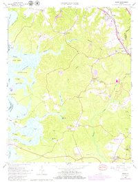
1965 Map of Norge
USGS Topo · Published 1980About this map
Norge and Lightfoot anchor the northeastern corridor of this coastal Virginia landscape, where the Chesapeake and Ohio railroad cuts a diagonal path toward the coast. The terrain is defined by a dense network of waterways and low-lying wetlands, including Yarmouth Swamp and Colby Swamp, which feed into the broad Chickahominy River and the Yarmouth River. This 1965 survey, updated with late-1970s revisions, illustrates the transitional nature of the land, featuring scattered Strip Mines and a Pipeline alongside established community centers like Centerville. Genealogists and local historians will find significant detail in the numerous country churches, such as Our Savior Ch, New Zion Ch, and Chickahominy Ch. The southern edge of the map touches the Colonial National Historical Park, reflecting the region's deep ties to early American settlement near Jamestown Farms.
Find a feature on this map
59 named features on this map. Tap any name to fly to it.
Don’t see what you’re looking for? This feature index may not catch every label — zoom into the map to look around manually.
Map Details
Editions of this 1965 Norge Map
3 editions found
Other maps of this area

1906 · Williamsburg
USGS Topo · 1:62,500

1907 · Yorktown
USGS Topo · 1:62,500

1917 · Toano
USGS Topo · 1:62,500

1918 · Toano
USGS Topo · 1:62,500

1919 · Surry
USGS Topo · 1:62,500

1943 · Yorktown
USGS Topo · 1:62,500

1943 · Richmond
USGS Topo · 1:250,000

1949 · Richmond
USGS Topo · 1:250,000

1950 · Cobham Bay
USGS Topo · 1:24,000
1951 · Williamsburg
USGS Topo · 1:24,000