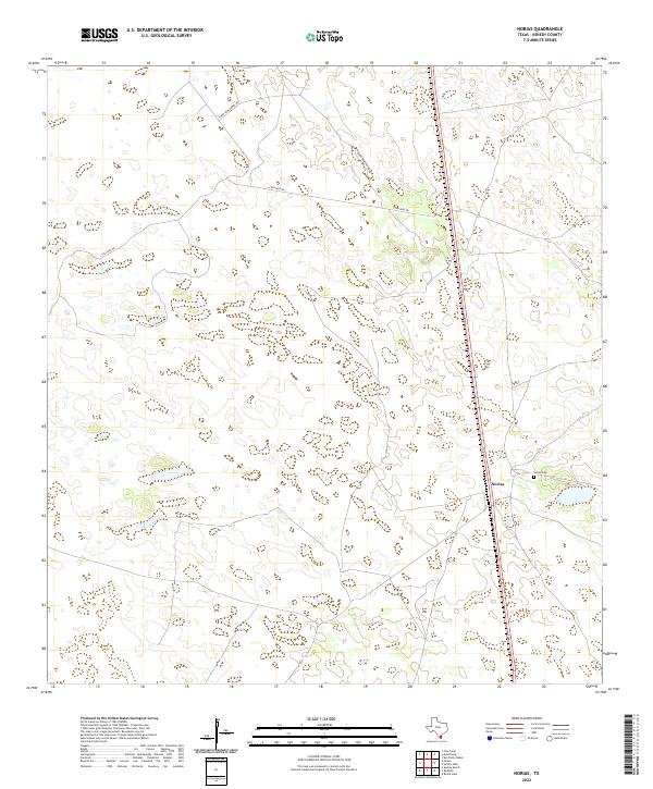
2022 Map of Norias
USGS Topo · Published 2022About this map
The isolated settlement of Norias anchors this coastal plain map in Kenedy County, characterized by a sparse network of ranch roads and numerous ephemeral wetlands. The landscape is defined by its rural connectivity, with Tobin Armstrong Rd and S Tullidos Rd providing the primary access through this sparsely populated territory. A small concentrated area of activity is centered around the community, where the Norias Cem serves as a significant local landmark for genealogists and family historians. This 2022 survey reflects the enduring character of South Texas ranching country, where large landholdings and environmental features like small ponds and depressions dictate the placement of local infrastructure and private transport routes.
Find a feature on this map
4 named features on this map. Tap any name to fly to it.
Don’t see what you’re looking for? This feature index may not catch every label — zoom into the map to look around manually.
Map Details
Editions of this 2022 Norias Map
This is the sole edition of this map. No revisions or reprints were ever made.
Other maps of this area

1921 · Tarida Ranch
USGS Topo · 1:62,500

1922 · La Sal Vieja
USGS Topo · 1:62,500

1923 · Armstrong
USGS Topo · 1:62,500

1923 · Saltillo Ranch
USGS Topo · 1:62,500

1953 · Brownsville
USGS Topo · 1:250,000

1956 · Pita Camp
USGS Topo · 1:24,000
1956 · Armstrong
USGS Topo · 1:24,000
1956 · San Pedro Ranch
USGS Topo · 1:24,000

1956 · Julian
USGS Topo · 1:24,000

1956 · Saltillo Well
USGS Topo · 1:24,000