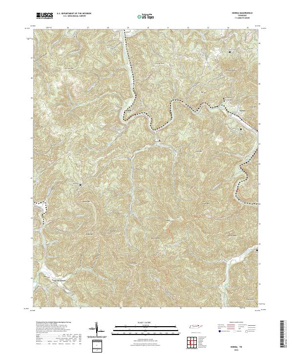
2022 Map of Norma
USGS Topo · Published 2022About this map
The New River and its numerous mountain tributaries carve through this pocket of the Cumberland Plateau, defining a landscape of deep hollows and high ridges in Scott County. Small settlements like Norma and Cordell represent the primary residential clusters, linked by winding routes such as Norma Rd and Cordell Rd. The terrain is characterized by named elevations like Gray Mtn and Cordell Mtn, while the Cumberland Mountains' industrial history is whispered in the presence of the Richland Coal Co Rd.
Find a feature on this map
88 named features on this map. Tap any name to fly to it.
Don’t see what you’re looking for? This feature index may not catch every label — zoom into the map to look around manually.
Map Details
Editions of this 2022 Norma Map
This is the sole edition of this map. No revisions or reprints were ever made.
Other maps of this area

1893 · Briceville
USGS Topo · 1:125,000

1895 · Wartburg
USGS Topo · 1:125,000

1895 · Briceville
USGS Topo · 1:125,000

1896 · Wartburg
USGS Topo · 1:125,000

1896 · Briceville
USGS Topo · 1:125,000

1935 · Gobey
USGS Topo · 1:24,000

1936 · Hogbell Gap
USGS Topo · 1:24,000

1936 · Block
USGS Topo · 1:24,000

1936 · Pioneer
USGS Topo · 1:24,000

1936 · Duncan Flats
USGS Topo · 1:24,000