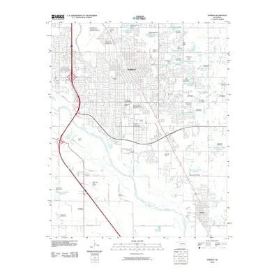
2010 Map of Norman
USGS Topo · Published 2010About this map
The University of Oklahoma anchors this central Oklahoma landscape, which includes the extensive University of Oklahoma South Campus and the University of Oklahoma Max Westheimer Airport. The sprawling municipal layout of Norman is punctuated by significant industrial development, including the Norman Townsite Oil Field and the Southeast Norman Oil Field. To the south, the Canadian River cuts through the terrain, with the community of Goldsby and the David Jay Perry Airport situated along its western banks. Geographically, the area is defined by a heavy concentration of water management features, including dozens of numbered reservoirs and dams such as Oknoname 02710 Reservoir and Oknoname 02708 Dam. For local historians, the presence of the Adkins Cemetery and established neighborhoods like Stubbeman Village and Hall Park provides evidence of the residential growth occurring alongside the region's oil and education sectors.
Find a feature on this map
78 named features on this map. Tap any name to fly to it.
Don’t see what you’re looking for? This feature index may not catch every label — zoom into the map to look around manually.
Map Details
Editions of this 2010 Norman Map
This is the sole edition of this map. No revisions or reprints were ever made.
Other maps of this area

1892 · Moore
USGS Topo · 1:62,500

1893 · Norman
USGS Topo · 1:62,500

1893 · Oklahoma City
USGS Topo · 1:62,500

1898 · Purcell
USGS Topo · 1:125,000

1904 · Chickasha
USGS Topo · 1:125,000

1925 · Norman NO 2
USGS Topo · 1:24,000

1934 · Moore
USGS Topo · 1:62,500

1936 · Norman
USGS Topo · 1:62,500

1938 · Moore
USGS Topo · 1:62,500

1954 · Oklahoma City
USGS Topo · 1:250,000