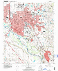
1995 Map of Norman
USGS Topo · Published 1999About this map
The University of Oklahoma and its sprawling academic and athletic facilities, including Owen Stadium, anchor the heart of Norman in the mid-1990s. The city's growth is framed by the Canadian River to the southwest and a series of industrial zones, such as the East Norman Oil Field and the Southeast Norman Oil Field. To the north and south, the academic presence extends into the University of Oklahoma Research Park and the Univ of Okla South Campus, illustrating the institution's role in local development.
Find a feature on this map
121 named features on this map. Tap any name to fly to it.
Don’t see what you’re looking for? This feature index may not catch every label — zoom into the map to look around manually.
Map Details
Editions of this 1995 Norman Map
This is the sole edition of this map. No revisions or reprints were ever made.
Other maps of this area

1892 · Moore
USGS Topo · 1:62,500

1893 · Norman
USGS Topo · 1:62,500

1893 · Oklahoma City
USGS Topo · 1:62,500

1898 · Purcell
USGS Topo · 1:125,000

1904 · Chickasha
USGS Topo · 1:125,000

1925 · Norman NO 2
USGS Topo · 1:24,000

1934 · Moore
USGS Topo · 1:62,500

1936 · Norman
USGS Topo · 1:62,500

1938 · Moore
USGS Topo · 1:62,500

1954 · Oklahoma City
USGS Topo · 1:250,000