
1925 Map of Norman NO 2
USGS Topo · Published 1925About this map
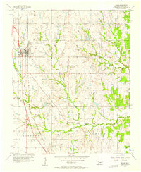
The University of Oklahoma grounds anchor the southern edge of Norman in the mid-1920s, a period when the town's grid was expanding toward the South Canadian River. This survey captures the region's educational and institutional landscape, highlighting the State Hospital and several rural schoolhouses like White Mound School and New Hope School that served the outlying farming communities. The transport network is defined by the Atchison Topeka & Santa Fe Electric line and State Highway No 4, which link the growing university town to the southern settlement of Noble. Beyond the developed areas, the terrain rises toward Fort Hill and is carved by Dave Blue Creek, showing a transition from the structured urban planning of Norman to the more irregular topography of Cleveland County's river bluffs.
Find a feature on this map
22 named features on this map. Tap any name to fly to it.
Don’t see what you’re looking for? This feature index may not catch every label — zoom into the map to look around manually.
Map Details
Editions of this 1925 Norman NO 2 Map
This is the sole edition of this map. No revisions or reprints were ever made.
Other maps of this area

1892 · Moore
USGS Topo · 1:62,500

1893 · Norman
USGS Topo · 1:62,500

1893 · Oklahoma City
USGS Topo · 1:62,500

1898 · Purcell
USGS Topo · 1:125,000

1904 · Chickasha
USGS Topo · 1:125,000

1934 · Moore
USGS Topo · 1:62,500

1936 · Norman
USGS Topo · 1:62,500

1938 · Moore
USGS Topo · 1:62,500

1954 · Oklahoma City
USGS Topo · 1:250,000
1956 · Moore
USGS Topo · 1:24,000