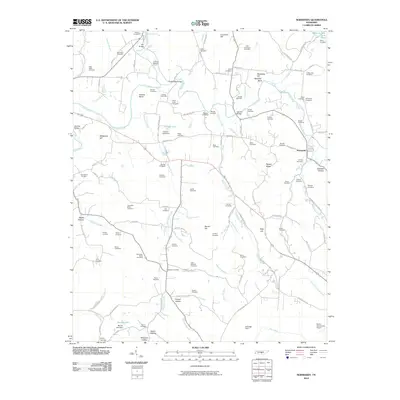
2010 Map of Normandy
USGS Topo · Published 2010About this map
The Duck River snakes through the heart of the Tennessee countryside, anchoring a landscape defined by century-old family legacies and rural infrastructure. Near the town of Normandy, the river’s path is marked by historical crossing points such as Dement Bridge and the Shofner Bridge. For genealogists, the map is remarkably dense with family-named burial grounds including Maupin Cemetery, Roberts Cemetery, and Hornaday-Miles Cemetery, providing a spatial record of the area’s early settlers. The topography transitions from the waters of Cortner Lake to prominent elevations like Meadows Hill and the distinctive Saltpeter Bluff. To the south, small-scale aviation is represented by the Parish Aerodrome Airport near the North Fork Rock Creek. This record documents the enduring rural character of Coffee and Bedford counties, where traditional land use and local geography remain closely tied to the drainage basins of Shipman Creek and Thompson Creek.
Find a feature on this map
95 named features on this map. Tap any name to fly to it.
Don’t see what you’re looking for? This feature index may not catch every label — zoom into the map to look around manually.
Map Details
Editions of this 2010 Normandy Map
This is the sole edition of this map. No revisions or reprints were ever made.
Other maps of this area

1913 · Hollow Springs
USGS Topo · 1:62,500

1936 · Ovoca
USGS Topo · 1:24,000

1936 · Booneville
USGS Topo · 1:24,000

1936 · Shelbyville
USGS Topo · 1:24,000

1936 · Deason
USGS Topo · 1:24,000

1936 · Cumberland Springs
USGS Topo · 1:24,000

1936 · Noah
USGS Topo · 1:24,000

1936 · Wartrace
USGS Topo · 1:24,000

1936 · Camp Peay
USGS Topo · 1:24,000

1936 · Normandy
USGS Topo · 1:24,000