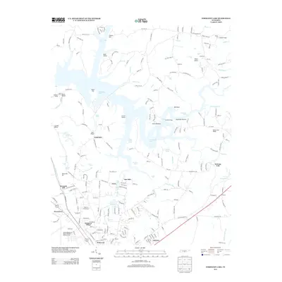
2013 Map of Normandy Lake
USGS Topo · Published 2013About this map
Normandy Lake dominates this Tennessee landscape, its winding waters held by the Duck River and punctuated by the sharp ridge of Devils Backbone. The geography of the early 21st century reveals a mix of recreational water bodies and residential growth, with named developments like Homaway Village, Briarwood, and Lake Hills clustered near the northern reaches of Tullahoma. Evidence of the region’s hydrological character is found in its numerous springs and cascades, including Machine Falls, Short Spring, and Rutledge Falls. Historical river crossings such as Bashaw Ford and Lees Ford remain identified along the upper river branches, while the Tullahoma Regional Airport/William Northern Field serves as a major regional landmark near the southern edge. The map also captures several smaller reservoirs like George Dickel Lake and Ovoca Lake, showing the continued importance of water management in this part of Coffee County.
Find a feature on this map
67 named features on this map. Tap any name to fly to it.
Don’t see what you’re looking for? This feature index may not catch every label — zoom into the map to look around manually.
Map Details
Editions of this 2013 Normandy Lake Map
This is the sole edition of this map. No revisions or reprints were ever made.
Other maps of this area

1913 · Hollow Springs
USGS Topo · 1:62,500

1936 · Ovoca
USGS Topo · 1:24,000

1936 · Fredonia
USGS Topo · 1:24,000

1936 · Manchester
USGS Topo · 1:24,000

1936 · Cumberland Springs
USGS Topo · 1:24,000

1936 · Noah
USGS Topo · 1:24,000

1936 · Wartrace
USGS Topo · 1:24,000

1936 · Camp Peay
USGS Topo · 1:24,000

1936 · Capitol Hill
USGS Topo · 1:24,000

1936 · Normandy
USGS Topo · 1:24,000