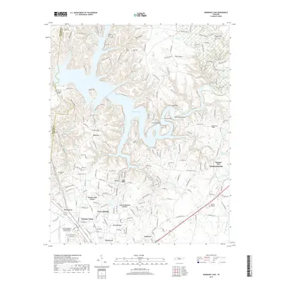
2019 Map of Normandy Lake
USGS Topo · Published 2019About this map
Normandy Lake dominates the central landscape of this Coffee County region, creating a complex shoreline that winds around the Devils Backbone and into Sugarcamp Bottoms. To the south, the city of Tullahoma serves as a primary hub, characterized by sprawling residential developments like Hickory Hill Estates, Homaway Village, and Briarwood. The presence of the Tullahoma Regional Airport/William Northern Field underscores the area's role as a regional center for transportation and infrastructure.
Find a feature on this map
211 named features on this map. Tap any name to fly to it.
Don’t see what you’re looking for? This feature index may not catch every label — zoom into the map to look around manually.
Map Details
Editions of this 2019 Normandy Lake Map
This is the sole edition of this map. No revisions or reprints were ever made.
Other maps of this area

1913 · Hollow Springs
USGS Topo · 1:62,500

1936 · Ovoca
USGS Topo · 1:24,000

1936 · Fredonia
USGS Topo · 1:24,000

1936 · Manchester
USGS Topo · 1:24,000

1936 · Cumberland Springs
USGS Topo · 1:24,000

1936 · Noah
USGS Topo · 1:24,000

1936 · Wartrace
USGS Topo · 1:24,000

1936 · Camp Peay
USGS Topo · 1:24,000

1936 · Capitol Hill
USGS Topo · 1:24,000

1936 · Normandy
USGS Topo · 1:24,000