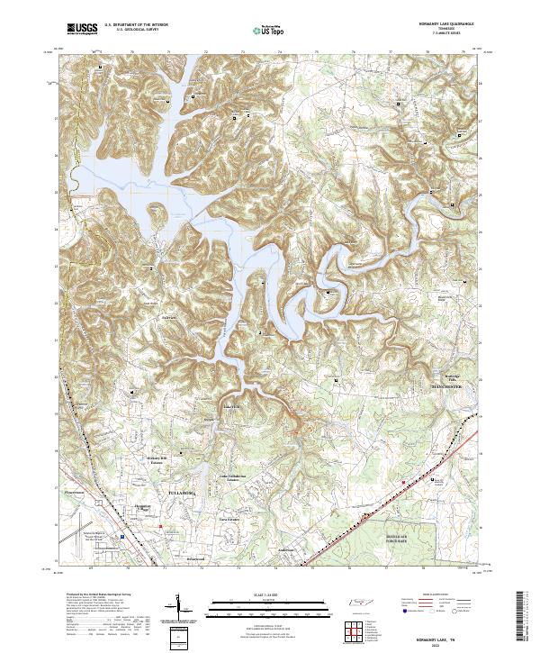
2022 Map of Normandy Lake
USGS Topo · Published 2022About this map
The Duck River and its intricate tributaries dominate this landscape in Bedford Co and Coffee Co. The sprawling waters of Normandy Lake fill the valleys between Goat Ridge and Devils Backbone, while the southern portion of the map transition into the residential expansions of Tullahoma and Manchester. This 2022 survey documents a modern landscape that remains deeply rooted in its agrarian and industrial past, evidenced by the high density of family-named cemeteries and the presence of George Dickel Lake.
Find a feature on this map
79 named features on this map. Tap any name to fly to it.
Don’t see what you’re looking for? This feature index may not catch every label — zoom into the map to look around manually.
Map Details
Editions of this 2022 Normandy Lake Map
This is the sole edition of this map. No revisions or reprints were ever made.
Other maps of this area

1913 · Hollow Springs
USGS Topo · 1:62,500

1936 · Ovoca
USGS Topo · 1:24,000

1936 · Fredonia
USGS Topo · 1:24,000

1936 · Manchester
USGS Topo · 1:24,000

1936 · Cumberland Springs
USGS Topo · 1:24,000

1936 · Noah
USGS Topo · 1:24,000

1936 · Wartrace
USGS Topo · 1:24,000

1936 · Camp Peay
USGS Topo · 1:24,000

1936 · Capitol Hill
USGS Topo · 1:24,000

1936 · Normandy
USGS Topo · 1:24,000