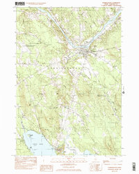
1982 Map of Norridgewock
USGS Topo · Published 1982About this map
The Kennebec River bends sharply through the town of Norridgewock, serving as the primary geographical axis for this central Maine landscape. In the early 1980s, the area's development concentrated near the river crossing, where the Maine Central railroad line runs parallel to the water through the village center. This survey documents the transition from the concentrated settlement at Norridgewock to the outlying agricultural and wooded tracts defined by prominent elevations like McIntyre Hill and Dodling Hill.
Find a feature on this map
52 named features on this map. Tap any name to fly to it.
Don’t see what you’re looking for? This feature index may not catch every label — zoom into the map to look around manually.
Map Details
Editions of this 1982 Norridgewock Map
2 editions found
Other maps of this area

1892 · Waterville
USGS Topo · 1:62,500

1894 · Norridgewock
USGS Topo · 1:62,500

1898 · Norridgewock
USGS Topo · 1:62,500

1904 · Anson
USGS Topo · 1:62,500

1913 · Skowhegan
USGS Topo · 1:62,500

1943 · Norridgewock
USGS Topo · 1:62,500

1943 · Waterville
USGS Topo · 1:62,500

1948 · Bangor
USGS Topo · 1:250,000

1955 · Anson
USGS Topo · 1:62,500

1955 · Skowhegan
USGS Topo · 1:62,500