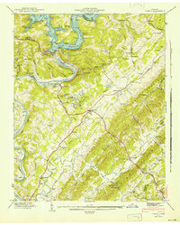
1941 Map of Norris
USGS Topo · Published 1941About this map
The Tennessee Valley Authority's engineering of the Clinch River is the central theme of this 1941 survey, dominated by the newly formed Norris Reservoir and the massive Norris Dam. The planned community of Norris sits at the heart of the landscape, connected by the Norris Freeway. This era of rapid transformation is documented alongside older, rural landmarks that predated the reservoir, including Lovely Mill and the Fish Hatchery near Miller Island.
Find a feature on this map
76 named features on this map. Tap any name to fly to it.
Don’t see what you’re looking for? This feature index may not catch every label — zoom into the map to look around manually.
Map Details
Editions of this 1941 Norris Map
2 editions found
Other maps of this area

1893 · Briceville
USGS Topo · 1:125,000

1895 · Briceville
USGS Topo · 1:125,000

1896 · Briceville
USGS Topo · 1:125,000

1897 · Maynardville
USGS Topo · 1:125,000

1900 · Maynardville
USGS Topo · 1:125,000

1935 · Fountain City
USGS Topo · 1:24,000

1936 · Gorryton
USGS Topo · 1:48,000

1936 · Jacksboro
USGS Topo · 1:24,000

1936 · White Hollow
USGS Topo · 1:24,000

1936 · La Follette
USGS Topo · 1:48,000