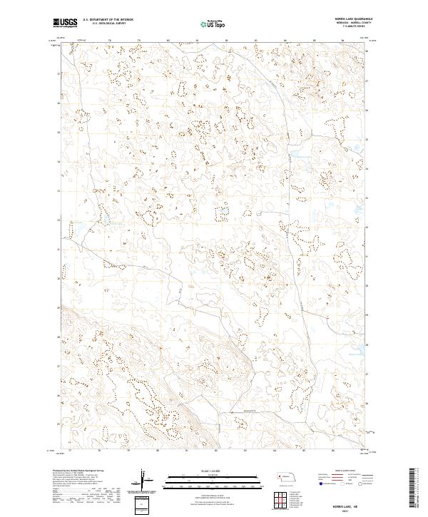
2021 Map of Norris Lake
USGS Topo · Published 2021About this map
Norris Lake and its surrounding alkali basins define this section of the Nebraska Sandhills in Morrill County. This high-plains landscape is characterized by a high concentration of ephemeral and permanent wetlands, including Box Lake and the Mud Lakes to the north, and Roach Lake at the southern edge. The distribution of these water bodies highlights the unique hydrology of the region, where groundwater levels intersect with the sandy depressions of the dunes.
Find a feature on this map
15 named features on this map. Tap any name to fly to it.
Don’t see what you’re looking for? This feature index may not catch every label — zoom into the map to look around manually.
Map Details
Editions of this 2021 Norris Lake Map
This is the sole edition of this map. No revisions or reprints were ever made.
Other maps of this area

1896 · Browns Creek
USGS Topo · 1:125,000

1899 · Browns Creek
USGS Topo · 1:125,000

1949 · Lynn
USGS Topo · 1:62,500

1950 · Storm Lake
USGS Topo · 1:62,500

1954 · Scottsbluff
USGS Topo · 1:250,000

1958 · Scottsbluff
USGS Topo · 1:250,000

1965 · Broadwater NW
USGS Topo · 1:24,000

1965 · Broadwater NE
USGS Topo · 1:24,000
1971 · Tar Valley
USGS Topo · 1:24,000

1985 · Crescent Lake
USGS Topo · 1:100,000