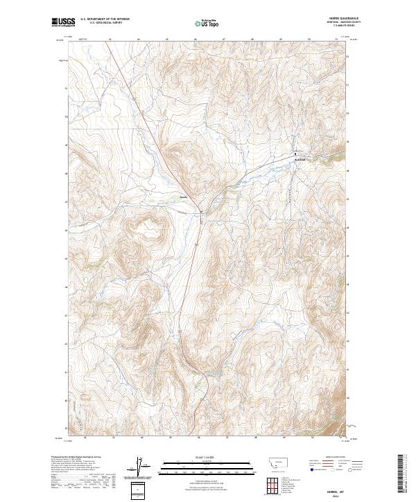
2024 Map of Norris
USGS Topo · Published 2024About this map
Norris and Red Bluff serve as the primary hubs in this Madison County landscape, where the geothermal activity of the Madison Range is evident at Bear Trap Hot Springs. The terrain is deeply carved by a network of drainage systems, including Hot Springs Creek, Woods Creek, and Burnt Creek, which dictate the placement of early travel routes like Sterling Rd. To the northeast, the Red Bluff Cem stands near the intersection of Cold Springs Rd, offering a specific point of interest for genealogical research in this part of Montana.
Find a feature on this map
22 named features on this map. Tap any name to fly to it.
Don’t see what you’re looking for? This feature index may not catch every label — zoom into the map to look around manually.
Map Details
Editions of this 2024 Norris Map
This is the sole edition of this map. No revisions or reprints were ever made.
Other maps of this area

1888 · Three Forks
USGS Topo · 1:250,000

1894 · Three Forks
USGS Topo · 1:250,000

1895 · Three Forks
USGS Topo · 1:250,000

1947 · Bozeman
USGS Topo · 1:250,000

1948 · Bozeman
USGS Topo · 1:250,000

1949 · Ennis
USGS Topo · 1:62,500

1949 · Norris
USGS Topo · 1:62,500

1950 · Harrison
USGS Topo · 1:62,500

1950 · Virginia City
USGS Topo · 1:62,500

1951 · Norris
USGS Topo · 1:62,500