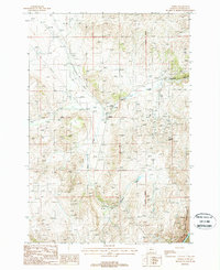
1988 Map of Norris
USGS Topo · Published 1988About this map
Norris stands as a focal point in this high-plains landscape, where the geography of resource extraction and thermal features intersect. The area is defined by its mining heritage, evidenced by the numerous Mine Shafts scattered across the hills and the specifically named Gubstake Mine. This industrial footprint is further marked by the Old Railroad Grade, which traces a path through the terrain where tracks once served the local economy.
Find a feature on this map
14 named features on this map. Tap any name to fly to it.
Don’t see what you’re looking for? This feature index may not catch every label — zoom into the map to look around manually.
Map Details
Editions of this 1988 Norris Map
This is the sole edition of this map. No revisions or reprints were ever made.
Other maps of this area

1888 · Three Forks
USGS Topo · 1:250,000

1894 · Three Forks
USGS Topo · 1:250,000

1895 · Three Forks
USGS Topo · 1:250,000

1947 · Bozeman
USGS Topo · 1:250,000

1948 · Bozeman
USGS Topo · 1:250,000

1949 · Ennis
USGS Topo · 1:62,500

1949 · Norris
USGS Topo · 1:62,500

1950 · Harrison
USGS Topo · 1:62,500

1950 · Virginia City
USGS Topo · 1:62,500

1951 · Norris
USGS Topo · 1:62,500