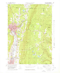
1973 Map of North Adams
USGS Topo · Published 1978About this map
The Hoosic River corridor serves as the industrial and social spine of this 1970s survey, connecting the urban center of North Adams with the mill-town settlements of Zylonite, Renfrew, and Adams. The map reveals a dense institutional footprint in the city, including North Adams State College, Drury High Sch, and numerous parish anchors like the St Josephs High Sch and Notre Dame Sch. The transition from city streets to the surrounding peaks is abrupt, with labels marking the high-altitude crossings at West Summit, Whitcomb Summit, and Eastern Summit along the winding mountain roads.
Find a feature on this map
95 named features on this map. Tap any name to fly to it.
Don’t see what you’re looking for? This feature index may not catch every label — zoom into the map to look around manually.
Map Details
Editions of this 1973 North Adams Map
4 editions found
Other maps of this area

1886 · Greylock
USGS Topo · 1:62,500

1886 · Hawley
USGS Topo · 1:62,500

1889 · Wilmington
USGS Topo · 1:62,500

1890 · Hawley
USGS Topo · 1:62,500

1891 · Wilmington
USGS Topo · 1:62,500

1891 · Greylock
USGS Topo · 1:62,500

1893 · Greylock
USGS Topo · 1:62,500

1894 · Hawley
USGS Topo · 1:62,500

1898 · Bennington
USGS Topo · 1:62,500

1898 · Greylock
USGS Topo · 1:62,500