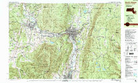
1988 Map of North Adams
USGS Topo · Published 1988About this map
The industrial and academic landscapes of the northern Berkshires converge where the Hoosic River meets its north and south branches. In Williamstown, the campus of Williams College sits adjacent to historical burial grounds like College Cem and Westlawn Cem, while the city of North Adams serves as a hub for the Boston and Maine railroad and local industry in Renfrew and Zylonite. The terrain is dominated by the massive rise of the Mt Greylock State Reservation, featuring the War Memorial Beacon at its summit and the Appalachian Trail tracing the ridge lines. The eastern portion of the map showcases the steep ascent of the Mohawk Trail State Forest and the engineering of the Central Shaft, reflecting the region's history of mountain transit and resource extraction. Significant state forests and parks, including Savoy Mountain State Forest and Clarksburg State Forest, create a nearly continuous corridor of protected highlands surrounding the river valleys.
Find a feature on this map
119 named features on this map. Tap any name to fly to it.
Don’t see what you’re looking for? This feature index may not catch every label — zoom into the map to look around manually.
Map Details
Editions of this 1988 North Adams Map
This is the sole edition of this map. No revisions or reprints were ever made.
Other maps of this area

1886 · Greylock
USGS Topo · 1:62,500

1886 · Hawley
USGS Topo · 1:62,500

1888 · Berlin
USGS Topo · 1:62,500

1889 · Wilmington
USGS Topo · 1:62,500

1890 · Hawley
USGS Topo · 1:62,500

1890 · Berlin
USGS Topo · 1:62,500

1891 · Wilmington
USGS Topo · 1:62,500

1891 · Greylock
USGS Topo · 1:62,500

1893 · Greylock
USGS Topo · 1:62,500

1894 · Berlin
USGS Topo · 1:62,500