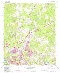
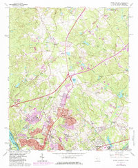
1964 Map of North Augusta
USGS Topo · Published 1981About this map
The Savannah River defines the southwestern edge of this survey, marking the state line between South Carolina and Georgia as the landscape transitions from the riverbanks toward the developed hills of North Augusta. During the mid-1960s, residential growth is evident in the burgeoning communities of Belvedere and Clearwater, while the northern reaches maintain a more rural character defined by agricultural clearings and small family landmarks. Several prominent religious and educational institutions serve these growing neighborhoods, including St Bartholomews Ch, Hammond Hill Sch, and Triune Sch.
Find a feature on this map
49 named features on this map. Tap any name to fly to it.
Don’t see what you’re looking for? This feature index may not catch every label — zoom into the map to look around manually.
Map Details
Editions of this 1964 North Augusta Map
5 editions found
Other maps of this area

1892 · Mc Cormick
USGS Topo · 1:125,000

1912 · Mc Cormick
USGS Topo · 1:125,000

1920 · Clarks Hill
USGS Topo · 1:48,000

1921 · Augusta
USGS Topo · 1:62,500

1921 · Clarks Hill
USGS Topo · 1:62,500

1922 · Hephzibah
USGS Topo · 1:62,500

1923 · Warrenville
USGS Topo · 1:48,000

1928 · Warrenville
USGS Topo · 1:62,500

1941 · Clarks Hill
USGS Topo · 1:62,500

1942 · Clarks Hill
USGS Topo · 1:62,500