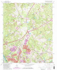
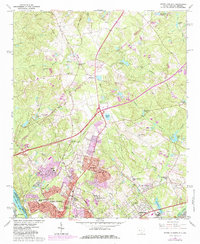
1964 Map of North Augusta
USGS Topo · Published 1984About this map
North Augusta and the surrounding Aiken County landscape appear here in a period of significant mid-century expansion, evidenced by the purple-shaded residential growth pushing north toward Belvedere and Sweetwater. The Savannah River defines the southwestern boundary, while the industrial character of the region is anchored by the Central of Georgia and Georgia Railroad lines. Several small clay extraction sites, labeled as Claypits, dot the landscape near Clearwater, hinting at the local brick and ceramic industries that shaped the area's economy.
Find a feature on this map
56 named features on this map. Tap any name to fly to it.
Don’t see what you’re looking for? This feature index may not catch every label — zoom into the map to look around manually.
Map Details
Editions of this 1964 North Augusta Map
5 editions found
Other maps of this area

1892 · Mc Cormick
USGS Topo · 1:125,000

1912 · Mc Cormick
USGS Topo · 1:125,000

1920 · Clarks Hill
USGS Topo · 1:48,000

1921 · Augusta
USGS Topo · 1:62,500

1921 · Clarks Hill
USGS Topo · 1:62,500

1922 · Hephzibah
USGS Topo · 1:62,500

1923 · Warrenville
USGS Topo · 1:48,000

1928 · Warrenville
USGS Topo · 1:62,500

1941 · Clarks Hill
USGS Topo · 1:62,500

1942 · Clarks Hill
USGS Topo · 1:62,500