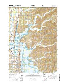
2014 Map of North Bend
USGS Topo · Published 2014About this map
Coos Bay and North Bend anchor this coastal landscape where the Coos River meets the Pacific. The intricate shoreline is defined by tidal features like Haynes Inlet, North Slough, and Pony Slough, connected by the landmark McCullough Memorial Bridge carrying the Oregon Coast Hwy. The 2014 survey documents the established infrastructure of the region, including the Southwest Oregon Regional Airport and the residential pockets of Glasgow and Cooston along the eastern shore. To the north, the Siuslaw National Forest contains a series of coastal bodies such as Teal Lake and Snag Lake. This map provides a detailed view of the water-dependent economy and settlement patterns of Coos County, from the industrial Marshfield Channel to the quiet reaches of Echo Valley and the North Bend Range.
Find a feature on this map
67 named features on this map. Tap any name to fly to it.
Don’t see what you’re looking for? This feature index may not catch every label — zoom into the map to look around manually.
Map Details
Editions of this 2014 North Bend Map
This is the sole edition of this map. No revisions or reprints were ever made.
Other maps of this area

1896 · Coos Bay
USGS Topo · 1:125,000

1898 · Coos Bay
USGS Topo · 1:125,000

1900 · Coos Bay
USGS Topo · 1:125,000

1923 · Reedsport
USGS Topo · 1:62,500

1942 · Reedsport
USGS Topo · 1:62,500

1942 · Empire
USGS Topo · 1:62,500

1942 · Coos Bay
USGS Topo · 1:62,500

1944 · Empire
USGS Topo · 1:62,500

1945 · Coos Bay
USGS Topo · 1:62,500

1954 · Coos Bay
USGS Topo · 1:250,000