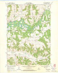
1969 Map of North Bend
USGS Topo · Published 1971About this map
The Black River meanders through this landscape, creating a complex network of sandbars and oxbows within the State Game Refuge between North Bend and Melrose. The map documents a predominantly agricultural region defined by its distinct "coulee" topography, where narrow valleys like Bell Coulee, Sullivan Coulee, and Wet Coulee carve into the uplands of Farmington. This 1969 field-checked survey captures the rural infrastructure of the era, from the centralized Melrose-Mindoro High Sch to local landmarks like Camp Ehawee. Genealogists will find several burial grounds noted, including Farmington Cem and Black Oak Cem, alongside vanished rural schoolhouses such as Red School and the Burr Oak Sch near the settlement of Burr Oak.
Find a feature on this map
53 named features on this map. Tap any name to fly to it.
Don’t see what you’re looking for? This feature index may not catch every label — zoom into the map to look around manually.
Map Details
Editions of this 1969 North Bend Map
2 editions found
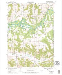
Other maps of this area

1909 · Sparta
USGS Topo · 1:62,500

1926 · North Bend
USGS Topo · 1:62,500

1927 · La Crosse
USGS Topo · 1:62,500

1928 · Melrose
USGS Topo · 1:48,000

1929 · North Bend
USGS Topo · 1:62,500

1930 · La Crosse
USGS Topo · 1:62,500

1947 · Sparta
USGS Topo · 1:62,500

1949 · Sparta
USGS Topo · 1:62,500

1949 · Melrose
USGS Topo · 1:62,500

1953 · Eau Claire
USGS Topo · 1:250,000