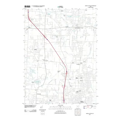
2010 Map of North Canton
USGS Topo · Published 2010About this map
The Tuscarawas River meanders through this landscape, which transitioned from rural farmland into a suburban and industrial corridor by the early 21st century. The map highlights established communities like Uniontown, Greentown, and Greensburg, each serving as a focal point for local residency and small-scale commerce. A significant industrial and transportation anchor is the Akron-Canton Regional Airport, which dominates the central portion of the quadrangle. For those researching family history, numerous burial grounds are documented, including Keiser Cemetery in the north and Saint Paul Cemetery near McDonaldsville. The presence of Tritts Millpond and several smaller bodies of water like Singer Lake and Willowdale Lake reflect the managed water resources and recreational spaces that define the area's development. This survey provides a clear view of the intersection of traditional settlements and modern infrastructure along Cleveland Ave NW and other primary routes.
Find a feature on this map
68 named features on this map. Tap any name to fly to it.
Don’t see what you’re looking for? This feature index may not catch every label — zoom into the map to look around manually.
Map Details
Editions of this 2010 North Canton Map
This is the sole edition of this map. No revisions or reprints were ever made.
Other maps of this area

1901 · Massillon
USGS Topo · 1:62,500

1901 · Canton
USGS Topo · 1:62,500

1903 · Massillon
USGS Topo · 1:62,500

1903 · Canton
USGS Topo · 1:62,500

1903 · Akron
USGS Topo · 1:62,500

1905 · Akron
USGS Topo · 1:62,500

1906 · Kent
USGS Topo · 1:62,500

1950 · Cleveland
USGS Topo · 1:250,000

1951 · Canton
USGS Topo · 1:250,000

1953 · Canton
USGS Topo · 1:250,000