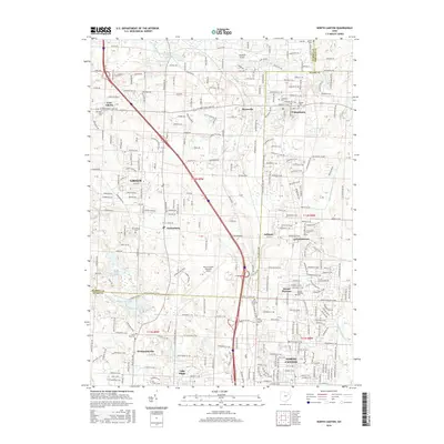
2016 Map of North Canton
USGS Topo · Published 2016About this map
North Canton and the suburban corridor stretching toward Uniontown and Greentown define this modern landscape at the boundary of Stark and Summit counties. The development of the Akron-Canton Regional Airport sits centrally, anchoring a network of commerce and logistics signaled by International Pkwy and Corporate Woods Pkwy. Despite the industrial and residential expansion, the area retains significant pockets of its original character, with long-standing family and community sites such as Saint Paul Cem, Greenlawn Cem, and Woods Cem preserved within the growing grid.
Find a feature on this map
77 named features on this map. Tap any name to fly to it.
Don’t see what you’re looking for? This feature index may not catch every label — zoom into the map to look around manually.
Map Details
Editions of this 2016 North Canton Map
This is the sole edition of this map. No revisions or reprints were ever made.
Other maps of this area

1901 · Massillon
USGS Topo · 1:62,500

1901 · Canton
USGS Topo · 1:62,500

1903 · Massillon
USGS Topo · 1:62,500

1903 · Canton
USGS Topo · 1:62,500

1903 · Akron
USGS Topo · 1:62,500

1905 · Akron
USGS Topo · 1:62,500

1906 · Kent
USGS Topo · 1:62,500

1950 · Cleveland
USGS Topo · 1:250,000

1951 · Canton
USGS Topo · 1:250,000

1953 · Canton
USGS Topo · 1:250,000