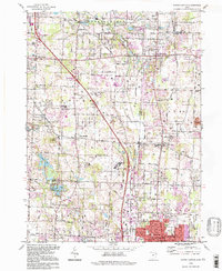
1994 Map of North Canton
USGS Topo · Published 1997About this map
The boundary lines of the Congress Lands, Western Reserve, and Seven Ranges converge across this landscape, marking a significant intersection of early Ohio surveying history. In the south, the city of North Canton anchors the map, while the Akron Canton Regional Airport dominates the central terrain alongside the Air National Guard facility. The presence of several gravel pits and a reclaimed strip mine highlights the area's industrial legacy of resource extraction.
Find a feature on this map
85 named features on this map. Tap any name to fly to it.
Don’t see what you’re looking for? This feature index may not catch every label — zoom into the map to look around manually.
Map Details
Editions of this 1994 North Canton Map
This is the sole edition of this map. No revisions or reprints were ever made.
Other maps of this area

1901 · Massillon
USGS Topo · 1:62,500

1901 · Canton
USGS Topo · 1:62,500

1903 · Massillon
USGS Topo · 1:62,500

1903 · Canton
USGS Topo · 1:62,500

1903 · Akron
USGS Topo · 1:62,500

1905 · Akron
USGS Topo · 1:62,500

1906 · Kent
USGS Topo · 1:62,500

1950 · Cleveland
USGS Topo · 1:250,000

1951 · Canton
USGS Topo · 1:250,000

1953 · Canton
USGS Topo · 1:250,000