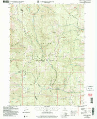
2005 Map of North Canyon
USGS Topo · Published 2007About this map
Sherman Peak rises as a central landmark within the Bear River Range, an area defined by deep drainages and high meadows along the border of Bear Lake, Caribou, and Franklin counties. This 2005 revision, based on earlier photogrammetry and updated imagery, illustrates a complex network of seasonal water sources and named hollows essential for high-altitude livestock grazing and resource management. The geography is carved by primary watercourses like Eightmile Creek and Stauffer Creek, while the presence of Moonlight Meadow and numerous springs such as Humberg Spring and Balsam Spring point to the area's vital role as a watershed.
Find a feature on this map
40 named features on this map. Tap any name to fly to it.
Don’t see what you’re looking for? This feature index may not catch every label — zoom into the map to look around manually.
Map Details
Editions of this 2005 North Canyon Map
This is the sole edition of this map. No revisions or reprints were ever made.
Other maps of this area

1909 · Montpelier
USGS Topo · 1:125,000

1911 · Montpelier
USGS Topo · 1:125,000

1911 · Slug Creek
USGS Topo · 1:62,500

1915 · Preston
USGS Topo · 1:96,000

1918 · Preston
USGS Topo · 1:125,000

1948 · Soda Springs
USGS Topo · 1:62,500

1949 · Soda Springs
USGS Topo · 1:62,500

1955 · Preston
USGS Topo · 1:250,000

1958 · Preston
USGS Topo · 1:250,000

1962 · Preston
USGS Topo · 1:250,000