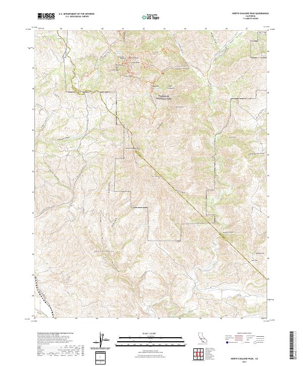
2021 Map of North Chalone Peak
USGS Topo · Published 2021About this map
Pinnacles National Park dominates the northern half of this landscape, showcasing the complex volcanic formations and steep drainage systems of the Gabilan Range. The topography is defined by sharp vertical features like Machete Ridge, the High Peaks, and the Resurrection Wall. These summits are linked by a dense network of hiking routes including the High Peaks Trl and Old Pinnacles Trl, reflecting the area's development as a protected natural space. To the south, the terrain transitions into the high drainage basins of Chalone Creek and the notable summits of North Chalone Peak and South Chalone Peak Trl. Springs such as Oak Tree Spring and Parson Spring provide rare water sources in this arid environment, while the presence of the Metz-Soledad Rd along the southwestern edge indicates the connection to the larger Salinas Valley corridor.
Find a feature on this map
74 named features on this map. Tap any name to fly to it.
Don’t see what you’re looking for? This feature index may not catch every label — zoom into the map to look around manually.
Map Details
Editions of this 2021 North Chalone Peak Map
This is the sole edition of this map. No revisions or reprints were ever made.
Other maps of this area

1912 · Metz
USGS Topo · 1:31,680

1915 · Soledad
USGS Topo · 1:62,500

1919 · San Benito
USGS Topo · 1:62,500

1921 · Gonzales
USGS Topo · 1:62,500

1921 · Metz
USGS Topo · 1:62,500

1931 · San Benito
USGS Topo · 1:62,500

1940 · Metz
USGS Topo · 1:62,500

1940 · Soledad
USGS Topo · 1:62,500

1940 · San Benito
USGS Topo · 1:62,500
1940 · Gonzales
USGS Topo · 1:62,500