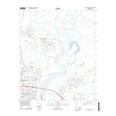
2014 Map of North Charleston
USGS Topo · Published 2014About this map
The Cooper River dominates this coastal landscape, winding past a network of islands and marshes including Big Island, Thomas Island, and Rhodens Island. In the early 21st century, the urban expansion of North Charleston and Hanahan is clearly visible, with residential neighborhoods like Liberty Hills and Lakeview pressing against the riparian edges. The transition from industrial corridors to historical landholdings is marked by sites such as the Yeamans Hall Plantation Cem and the waters of Gold Cup Springs.
Find a feature on this map
144 named features on this map. Tap any name to fly to it.
Don’t see what you’re looking for? This feature index may not catch every label — zoom into the map to look around manually.
Map Details
Editions of this 2014 North Charleston Map
This is the sole edition of this map. No revisions or reprints were ever made.
Other maps of this area

1919 · Ladson
USGS Topo · 1:21,120

1919 · Johns Island
USGS Topo · 1:21,120

1919 · Summerville
USGS Topo · 1:48,000

1919 · Wando
USGS Topo · 1:21,120

1919 · Cordesville
USGS Topo · 1:48,000

1919 · Melgrove
USGS Topo · 1:21,120

1919 · Charleston
USGS Topo · 1:21,120

1919 · Fort Moultrie
USGS Topo · 1:21,120

1920 · Ravenels
USGS Topo · 1:62,500

1920 · Summerville
USGS Topo · 1:62,500