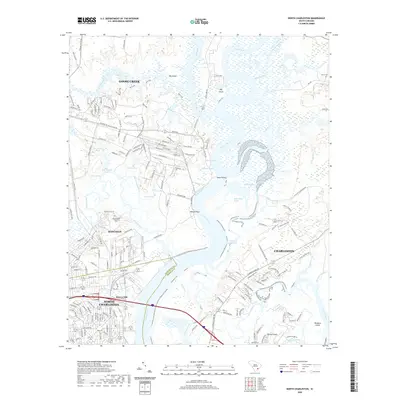
2020 Map of North Charleston
USGS Topo · Published 2020About this map
The Cooper River corridor dominates this coastal South Carolina landscape, defining the industrial and maritime character of the region. Navigational points like Slack Reach and Back Slack Reach reveal the complex hydrology where the river meets the Back River and Clouter Creek. On the western banks, the urban expansion of North Charleston and Hanahan is evident, yet legacy sites like the Yeamans Hall Plantation Cem remain preserved amidst the growing suburban network.
Find a feature on this map
199 named features on this map. Tap any name to fly to it.
Don’t see what you’re looking for? This feature index may not catch every label — zoom into the map to look around manually.
Map Details
Editions of this 2020 North Charleston Map
This is the sole edition of this map. No revisions or reprints were ever made.
Other maps of this area

1919 · Ladson
USGS Topo · 1:21,120

1919 · Johns Island
USGS Topo · 1:21,120

1919 · Summerville
USGS Topo · 1:48,000

1919 · Wando
USGS Topo · 1:21,120

1919 · Cordesville
USGS Topo · 1:48,000

1919 · Melgrove
USGS Topo · 1:21,120

1919 · Charleston
USGS Topo · 1:21,120

1919 · Fort Moultrie
USGS Topo · 1:21,120

1920 · Ravenels
USGS Topo · 1:62,500

1920 · Summerville
USGS Topo · 1:62,500