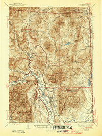
1945 Map of North Conway
USGS Topo · Published 1945About this map
The Saco River valley serves as the primary artery for settlement and commerce throughout this region of the White Mountains during the mid-1940s. Villages such as North Conway, Jackson, and Bartlett are shown connected by the Maine Central and Boston and Maine railroads, highlighting the area's importance as a transportation hub. The landscape is heavily defined by high peaks and recreation, featuring the Cold River AMC Camp and numerous backcountry structures like Black Mtn Cabin and the Davis Memorial Tower. Land use patterns are dictated by the topography, with most development hugging the narrow lowlands near Echo Lake and Goodrich Falls, while the surrounding slopes are protected within the White Mountain National Forest and Merriman State Forest.
Find a feature on this map
155 named features on this map. Tap any name to fly to it.
Don’t see what you’re looking for? This feature index may not catch every label — zoom into the map to look around manually.
Map Details
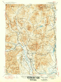
Editions of this 1945 North Conway Map
3 editions found

Other maps of this area

1893 · Mt. Washington
USGS Topo · 1:62,500

1893 · Gorham
USGS Topo · 1:62,500

1894 · North Conway
USGS Topo · 1:62,500

1895 · Crawford Notch
USGS Topo · 1:62,500

1896 · Mt. Washington
USGS Topo · 1:62,500

1896 · Crawford Notch
USGS Topo · 1:62,500

1896 · North Conway
USGS Topo · 1:62,500

1896 · Gorham
USGS Topo · 1:62,500

1909 · Fryeburg
USGS Topo · 1:62,500

1910 · Kezar Falls
USGS Topo · 1:48,000