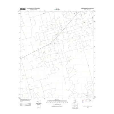
2012 Map of North Cowden NW
USGS Topo · Published 2012About this map
Fuhrman Mascho Oil Field and the Embar Oil Field dominate this industrial landscape in West Texas, reflecting the intensive resource extraction characteristic of Andrews County in the early 21st century. The map reveals an intricate network of service roads and lease routes, such as Thornberry Rd and Target Rd, which lace together the various drilling sites and production facilities. This geometric web of infrastructure illustrates the methodical development of the Permian Basin's energy reserves.
Find a feature on this map
20 named features on this map. Tap any name to fly to it.
Don’t see what you’re looking for? This feature index may not catch every label — zoom into the map to look around manually.
Map Details
Editions of this 2012 North Cowden NW Map
This is the sole edition of this map. No revisions or reprints were ever made.
Other maps of this area

1954 · Hobbs
USGS Topo · 1:250,000

1958 · Hobbs
USGS Topo · 1:250,000

1963 · Andrews
USGS Topo · 1:24,000

1967 · North Cowden
USGS Topo · 1:24,000

1968 · Coyote Corner
USGS Topo · 1:24,000

1968 · North Cowden NW
USGS Topo · 1:24,000

1968 · Clabber Hill Ranch
USGS Topo · 1:24,000

1971 · Whalen Lake
USGS Topo · 1:24,000

1971 · Bedford Ranch
USGS Topo · 1:24,000

1971 · Sand Ranch
USGS Topo · 1:24,000