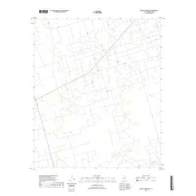
2019 Map of North Cowden NW
USGS Topo · Published 2019About this map
State highway and county road networks define this West Texas landscape in the late 2010s, illustrating the systematic parceling of Andrews County. The primary arterial route, S Fm 181, cuts across the southwestern corner, while a dense grid of local access roads serves the region's industrial and ranching interests. Roads such as Sw 4000, Sw 5000, and Sw 5500 create a distinctive geometric pattern across the terrain, reflecting the modern infrastructure required for resource extraction and land management. Small depressions and intermittent water features are scattered throughout the quadrangle, particularly near Sw 4001. The intersection of larger thoroughfares like Co Rd 7000 at the southern boundary provides a clear look at the regional connectivity of this high plains area.
Find a feature on this map
18 named features on this map. Tap any name to fly to it.
Don’t see what you’re looking for? This feature index may not catch every label — zoom into the map to look around manually.
Map Details
Editions of this 2019 North Cowden NW Map
This is the sole edition of this map. No revisions or reprints were ever made.
Other maps of this area

1954 · Hobbs
USGS Topo · 1:250,000

1958 · Hobbs
USGS Topo · 1:250,000

1963 · Andrews
USGS Topo · 1:24,000

1967 · North Cowden
USGS Topo · 1:24,000

1968 · Coyote Corner
USGS Topo · 1:24,000

1968 · North Cowden NW
USGS Topo · 1:24,000

1968 · Clabber Hill Ranch
USGS Topo · 1:24,000

1971 · Whalen Lake
USGS Topo · 1:24,000

1971 · Bedford Ranch
USGS Topo · 1:24,000

1971 · Sand Ranch
USGS Topo · 1:24,000