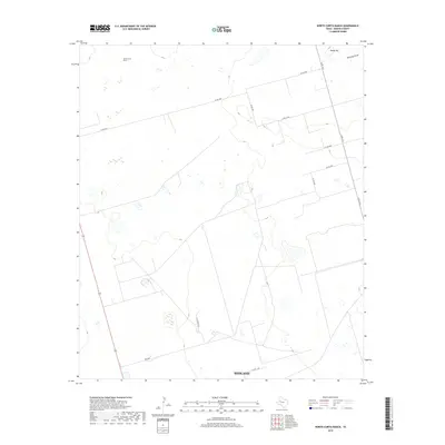
2019 Map of North Curtis Ranch
USGS Topo · Published 2019About this map
North Curtis Ranch sits in the high plains of West Texas, north of Midland, where the terrain is defined by a series of shallow depressions and ephemeral water features. The most prominent natural landmark is Range Hill, located in the northeastern corner of the map near the head of Mustang Draw. This landscape is partitioned by a strictly geometric road network typical of the Permian Basin's ranching and resource-extraction heritage, including N FM 1212 and Co Rd 3200. The presence of many smaller, unpaved routes like Lazy Ranch Rd and Pvt Rd 3000 illustrates the ongoing utility of this land for private agricultural and industrial operations in the late 2010s.
Find a feature on this map
14 named features on this map. Tap any name to fly to it.
Don’t see what you’re looking for? This feature index may not catch every label — zoom into the map to look around manually.
Map Details
Editions of this 2019 North Curtis Ranch Map
This is the sole edition of this map. No revisions or reprints were ever made.
Other maps of this area

1954 · Hobbs
USGS Topo · 1:250,000

1954 · Big Spring
USGS Topo · 1:250,000

1958 · Big Spring
USGS Topo · 1:250,000

1958 · Hobbs
USGS Topo · 1:250,000

1965 · Northeast Midland
USGS Topo · 1:24,000

1966 · Lenorah West
USGS Topo · 1:24,000

1966 · Mabee Ranch
USGS Topo · 1:24,000

1966 · Flynt Ranch
USGS Topo · 1:24,000

1966 · Bird Ranch
USGS Topo · 1:24,000
1966 · Germania
USGS Topo · 1:24,000