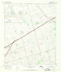
1966 Map of Germania
USGS Topo · Published 1968About this map
Texas and Pacific rails cut a sharp diagonal through the Permian Basin landscape in the mid-1960s, defining the corridor between Germania and Greenwood. This semi-arid terrain in the West Texas oil patch is characterized by a dense network of a Pipeline infrastructure and numerous wells, reflecting the intensive industrialization of the era. Natural features like Salt Lake and the winding Mustang Draw provide a stark contrast to the rectilinear grid of county roads and survey lines. The boundary between Martin and Midland counties bisects the region, where the economy was driven by petroleum extraction and extractive industries, as evidenced by several Gravel Pits and Borrow Pits clustered near the railroad. For those studying the evolution of Texas oil towns, the map reveals the layout of these small settlements before significant modern expansion altered their footprint.
Find a feature on this map
12 named features on this map. Tap any name to fly to it.
Don’t see what you’re looking for? This feature index may not catch every label — zoom into the map to look around manually.
Map Details
Editions of this 1966 Germania Map
2 editions found
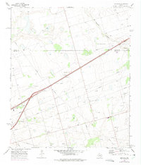
Other maps of this area

1954 · Hobbs
USGS Topo · 1:250,000

1954 · Pecos
USGS Topo · 1:250,000

1954 · Big Spring
USGS Topo · 1:250,000

1954 · San Angelo
USGS Topo · 1:250,000

1957 · Pecos
USGS Topo · 1:250,000

1958 · San Angelo
USGS Topo · 1:250,000

1958 · Big Spring
USGS Topo · 1:250,000

1958 · Hobbs
USGS Topo · 1:250,000

1965 · San Angelo
USGS Topo · 1:250,000

1965 · Southeast Midland
USGS Topo · 1:24,000