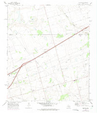
1966 Map of Germania
USGS Topo · Published 1975About this map
The Texas and Pacific railroad forms a dominant diagonal axis across this West Texas landscape, connecting the small settlement of Germania to the wider region. In the mid-1960s, the terrain was characterized by a mix of natural drainage features and industrial infrastructure, including a network of pipelines that traverse the oil-rich plains. To the north, Mustang Draw and Salt Lake mark the local topography, while the boundary between Martin and Midland counties bisects the survey area. Resource extraction is evident through several Gravel Pits and Borrow Pits scattered near the rail line and main thoroughfares. A distinctive landmark, Stanton South Base, stands as a point of reference in the northeastern quadrant, reflecting the systematic surveying of this semi-arid region during a period of steady industrial expansion.
Find a feature on this map
11 named features on this map. Tap any name to fly to it.
Don’t see what you’re looking for? This feature index may not catch every label — zoom into the map to look around manually.
Map Details
Editions of this 1966 Germania Map
2 editions found
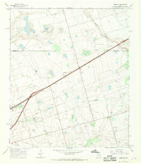
Other maps of this area

1954 · Hobbs
USGS Topo · 1:250,000

1954 · Pecos
USGS Topo · 1:250,000

1954 · Big Spring
USGS Topo · 1:250,000

1954 · San Angelo
USGS Topo · 1:250,000

1957 · Pecos
USGS Topo · 1:250,000

1958 · San Angelo
USGS Topo · 1:250,000

1958 · Big Spring
USGS Topo · 1:250,000

1958 · Hobbs
USGS Topo · 1:250,000

1965 · San Angelo
USGS Topo · 1:250,000

1965 · Southeast Midland
USGS Topo · 1:24,000