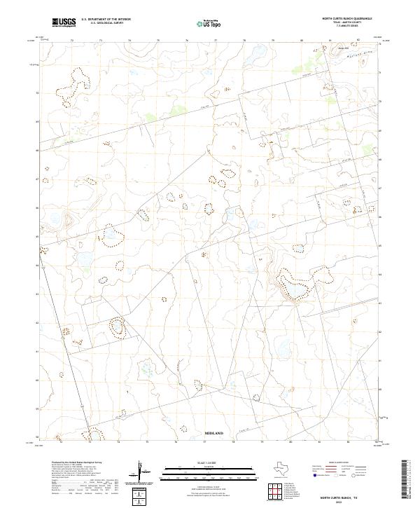
2022 Map of North Curtis Ranch
USGS Topo · Published 2022About this map
Mustang Draw winds through this West Texas ranching landscape, providing a primary drainage feature in an area defined by its expansive topography. Situated along the boundary with Midland, the terrain is punctuated by Range Hill in the northeast, offering a rare point of elevation in a region characterized by its broad basins and subtle rises. The network of roads, including Lazy Ranch Rd and N Fm 1212, reveals a pattern of modern land division and rural access. These corridors, such as Co Rd 3200 and Pyt Rd 3000, suggest a landscape dedicated to large-scale ranching and mineral exploration, typical of the Permian Basin's outskirts where infrastructure is built to support the region's energy and agricultural economies.
Find a feature on this map
13 named features on this map. Tap any name to fly to it.
Don’t see what you’re looking for? This feature index may not catch every label — zoom into the map to look around manually.
Map Details
Editions of this 2022 North Curtis Ranch Map
This is the sole edition of this map. No revisions or reprints were ever made.
Other maps of this area

1954 · Hobbs
USGS Topo · 1:250,000

1954 · Big Spring
USGS Topo · 1:250,000

1958 · Big Spring
USGS Topo · 1:250,000

1958 · Hobbs
USGS Topo · 1:250,000

1965 · Northeast Midland
USGS Topo · 1:24,000

1966 · Lenorah West
USGS Topo · 1:24,000

1966 · Mabee Ranch
USGS Topo · 1:24,000

1966 · Flynt Ranch
USGS Topo · 1:24,000

1966 · Bird Ranch
USGS Topo · 1:24,000
1966 · Germania
USGS Topo · 1:24,000