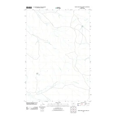
2011 Map of North Fork Alkali Creek
USGS Topo · Published 2011About this map
North Fork Alkali Creek defines the lower drainage of this arid landscape in southeastern Montana, where life is shaped by the presence and management of seasonal water. The 2011 topography reveals a network of intermittent stream beds, including Straight Creek and Antelope Creek, that converge toward larger watersheds. Evidence of land and water management is visible through ranching-related infrastructure like Cold Springs Dam in the northeast and H M Scott Number 2 Dam to the west. Transportation in this corner of Carter County is sparse, relying on primary routes such as Trail Creek Rd and Mispah Rd to connect the high plains. The landscape's character is one of open range, where many creek names like Dugout Creek and Hay Creek reflect the utilitarian needs and landmarks of early settlers.
Find a feature on this map
12 named features on this map. Tap any name to fly to it.
Don’t see what you’re looking for? This feature index may not catch every label — zoom into the map to look around manually.
Map Details
Editions of this 2011 North Fork Alkali Creek Map
This is the sole edition of this map. No revisions or reprints were ever made.
Other maps of this area

1953 · Miles City
USGS Topo · 1:250,000

1954 · Ekalaka
USGS Topo · 1:250,000

1956 · Ekalaka
USGS Topo · 1:250,000

1957 · Miles City
USGS Topo · 1:250,000

1958 · Miles City
USGS Topo · 1:250,000

1958 · Ekalaka
USGS Topo · 1:250,000

1965 · Ekalaka
USGS Topo · 1:250,000

1969 · Tepee Butte NE
USGS Topo · 1:24,000

1969 · Tepee Butte
USGS Topo · 1:24,000

1979 · Blacktail Creek NW
USGS Topo · 1:24,000