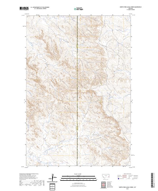
2024 Map of North Fork Alkali Creek
USGS Topo · Published 2024About this map
The Miles City Cutoff traverses a rugged landscape on the border of Custer and Carter Counties in southeastern Montana. This area is defined by a dense network of intermittent drainage systems, including the headwaters of North Fork Alkali Creek and the southern flow of Straight Creek. The land follows a classic Western township and range pattern, with the boundary between Range 54 East and Range 55 East dividing the terrain. Water sources like Antelope Creek and Hay Creek carve through the high ground, illustrating the hydrological importance of this region to local ranching operations. The presence of named tracks like Rd 428 alongside these seasonal waterways highlights the enduring connectivity between isolated pastures and the historical route toward Miles City.
Find a feature on this map
15 named features on this map. Tap any name to fly to it.
Don’t see what you’re looking for? This feature index may not catch every label — zoom into the map to look around manually.
Map Details
Editions of this 2024 North Fork Alkali Creek Map
This is the sole edition of this map. No revisions or reprints were ever made.
Other maps of this area

1953 · Miles City
USGS Topo · 1:250,000

1954 · Ekalaka
USGS Topo · 1:250,000

1956 · Ekalaka
USGS Topo · 1:250,000

1957 · Miles City
USGS Topo · 1:250,000

1958 · Miles City
USGS Topo · 1:250,000

1958 · Ekalaka
USGS Topo · 1:250,000

1965 · Ekalaka
USGS Topo · 1:250,000

1969 · Tepee Butte NE
USGS Topo · 1:24,000

1969 · Tepee Butte
USGS Topo · 1:24,000

1979 · Blacktail Creek NW
USGS Topo · 1:24,000