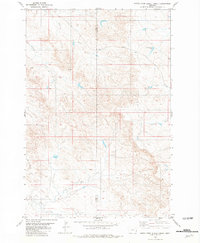
1981 Map of North Fork Alkali Creek
USGS Topo · Published 1981About this map
North Fork Alkali Creek flows through a remote stretch of the Montana plains along the border of Custer and Carter counties. This 1981 survey, based on aerial photography from the mid-1970s, illustrates a landscape primarily shaped by drainage and ranching infrastructure rather than concentrated settlement. Significant water management features like Cold Springs Dam and the simple label for Dugout indicate the importance of water retention in this arid environment. The presence of a Drill Hole near the center of the sheet suggests mineral or geological exploration common to the region during this period. The terrain is defined by a network of intermittent streams including Straight Creek and Hay Creek, which carve through the high ground to meet the larger Alkali Creek system.
Find a feature on this map
8 named features on this map. Tap any name to fly to it.
Don’t see what you’re looking for? This feature index may not catch every label — zoom into the map to look around manually.
Map Details
Editions of this 1981 North Fork Alkali Creek Map
This is the sole edition of this map. No revisions or reprints were ever made.
Other maps of this area

1953 · Miles City
USGS Topo · 1:250,000

1954 · Ekalaka
USGS Topo · 1:250,000

1956 · Ekalaka
USGS Topo · 1:250,000

1957 · Miles City
USGS Topo · 1:250,000

1958 · Miles City
USGS Topo · 1:250,000

1958 · Ekalaka
USGS Topo · 1:250,000

1965 · Ekalaka
USGS Topo · 1:250,000

1969 · Tepee Butte NE
USGS Topo · 1:24,000

1969 · Tepee Butte
USGS Topo · 1:24,000

1979 · Blacktail Creek NW
USGS Topo · 1:24,000