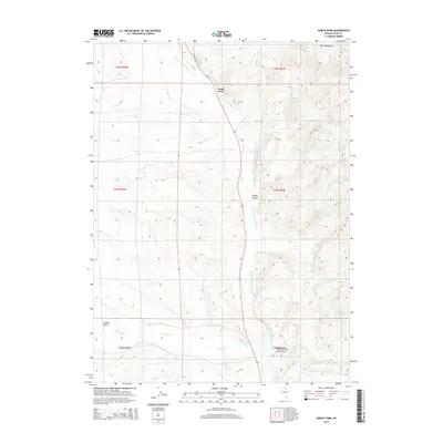
2014 Map of North Fork
USGS Topo · Published 2014About this map
North Fork serves as the central focal point for this landscape in Elko County, where the N Fork Humboldt River carves through the high desert. The map captures a high-elevation terrain defined by the Bone Mountains to the northeast and the wide, sweeping Valley of the North Fork to the south. This area is characterized by its vital water sources in an otherwise arid environment, including named points like Chicken Springs and Truett Spring. The drainage patterns are intricate, with seasonal flows such as Pratt Cr, Sheep Cr, and Foreman Cr converging toward the primary river corridor. This topographical record illustrates the remote ranching and grazing lands of northeastern Nevada, where navigation relies on features like Dorsey Canyon and the solitary Sage Crest Dr.
Find a feature on this map
22 named features on this map. Tap any name to fly to it.
Don’t see what you’re looking for? This feature index may not catch every label — zoom into the map to look around manually.
Map Details
Editions of this 2014 North Fork Map
This is the sole edition of this map. No revisions or reprints were ever made.
Other maps of this area

1935 · Charleston
USGS Topo · 1:48,000

1942 · Mt. Velma
USGS Topo · 1:62,500

1955 · Wells
USGS Topo · 1:250,000

1956 · Wild Horse
USGS Topo · 1:62,500

1958 · Wells
USGS Topo · 1:250,000

1961 · Wells
USGS Topo · 1:250,000

1971 · Mahala Creek West
USGS Topo · 1:24,000

1971 · Double Mtn
USGS Topo · 1:24,000

1971 · North Fork
USGS Topo · 1:24,000

1971 · California Mtn.
USGS Topo · 1:24,000