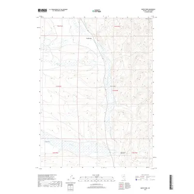
2018 Map of North Fork
USGS Topo · Published 2018About this map
N Fork Humboldt River dominates this high-desert basin in Elko County, defining the drainage patterns and historical path of travel through the Valley of the North Fork. The small settlement of North Fork serves as a lone human outpost in a landscape carved by seasonal waterways like Sheep Cr and Pratt Cr. To the northeast, the Bone Mountains rise sharply, providing a topographic contrast to the broad alluvial valley below. This environment is characterized by its vital water sources, including remote features such as Truett Spring and Chicken Springs. The map reveals the intricate network of canyons and draws, such as Dorsey Canyon and Connell Draw, which channel runoff from the surrounding peaks into the river system. This modern survey reflects the enduring character of a region where ranching and natural resources remain central to the local geography.
Find a feature on this map
21 named features on this map. Tap any name to fly to it.
Don’t see what you’re looking for? This feature index may not catch every label — zoom into the map to look around manually.
Map Details
Editions of this 2018 North Fork Map
This is the sole edition of this map. No revisions or reprints were ever made.
Other maps of this area

1935 · Charleston
USGS Topo · 1:48,000

1942 · Mt. Velma
USGS Topo · 1:62,500

1955 · Wells
USGS Topo · 1:250,000

1956 · Wild Horse
USGS Topo · 1:62,500

1958 · Wells
USGS Topo · 1:250,000

1961 · Wells
USGS Topo · 1:250,000

1971 · Mahala Creek West
USGS Topo · 1:24,000

1971 · Double Mtn
USGS Topo · 1:24,000

1971 · North Fork
USGS Topo · 1:24,000

1971 · California Mtn.
USGS Topo · 1:24,000