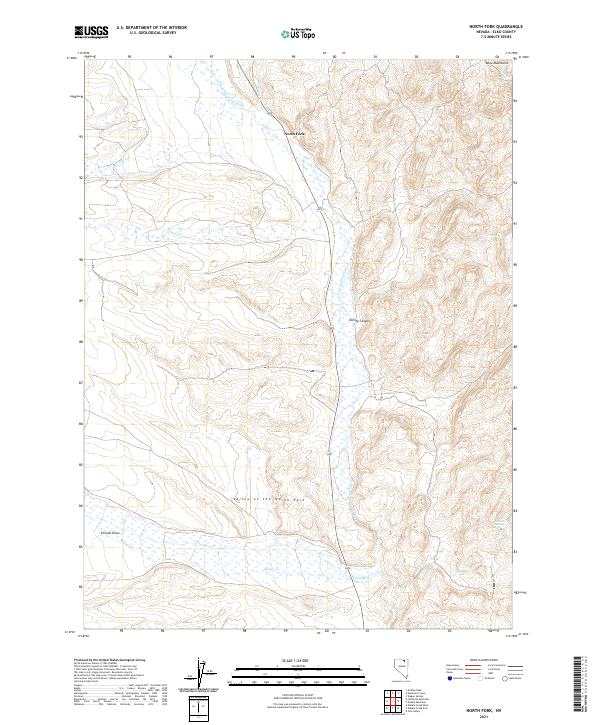
2021 Map of North Fork
USGS Topo · Published 2021About this map
The N Fork Humboldt River carves a central path through this high-desert basin in Elko County, defining the drainage patterns for numerous seasonal and permanent tributaries. This 2021 update documents the contemporary landscape of the Valley of the North Fork, where the small settlement of North Fork serves as a lone waypoint along Route 225. The terrain rises sharply to the east into the Bone Mountains, punctuated by distinctive breaks like Dorsey Canyon.
Find a feature on this map
22 named features on this map. Tap any name to fly to it.
Don’t see what you’re looking for? This feature index may not catch every label — zoom into the map to look around manually.
Map Details
Editions of this 2021 North Fork Map
This is the sole edition of this map. No revisions or reprints were ever made.
Other maps of this area

1935 · Charleston
USGS Topo · 1:48,000

1942 · Mt. Velma
USGS Topo · 1:62,500

1955 · Wells
USGS Topo · 1:250,000

1956 · Wild Horse
USGS Topo · 1:62,500

1958 · Wells
USGS Topo · 1:250,000

1961 · Wells
USGS Topo · 1:250,000

1971 · Mahala Creek West
USGS Topo · 1:24,000

1971 · Double Mtn
USGS Topo · 1:24,000

1971 · North Fork
USGS Topo · 1:24,000

1971 · California Mtn.
USGS Topo · 1:24,000