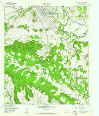
1958 Map of North Fort Hood
USGS Topo · Published 1961About this map
North Fort Hood dominates the northern section of this 1958 survey, showing a structured military cantonment with named thoroughfares like Main Street and Central Avenue alongside a Landing Strip. South of the base, the landscape transitions into the sharp relief of the Henson Mountains, where high points such as Dalton Mountain and King Mountain overlook a complex drainage system including Henson Creek and Owl Creek.
Find a feature on this map
42 named features on this map. Tap any name to fly to it.
Don’t see what you’re looking for? This feature index may not catch every label — zoom into the map to look around manually.
Map Details
Editions of this 1958 North Fort Hood Map
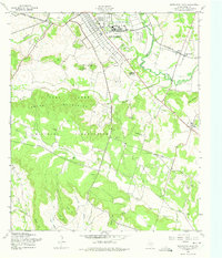
2 editions found
Other maps of this area

1894 · Gatesville
USGS Topo · 1:125,000

1924 · Gatesville 4-a
USGS Topo · 1:48,000

1930 · Killeen
USGS Topo · 1:62,500

1947 · Fort Hood
USGS Topo · 1:62,500

1947 · Bland
USGS Topo · 1:24,000

1947 · Fort Hood
USGS Topo · 1:24,000

1947 · Purmela
USGS Topo · 1:62,500

1947 · Post Oak Mountain
USGS Topo · 1:24,000

1947 · Killeen
USGS Topo · 1:62,500

1947 · Oglesby
USGS Topo · 1:24,000