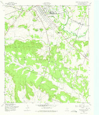
1958 Map of North Fort Hood
USGS Topo · Published 1975About this map
Leon River valley and the adjacent Henson Mountains define this mid-century view of the Fort Hood Military Reservation. The map details the transition from rural Coryell County homesteads to military infrastructure, showing the cantonment area of North Fort Hood with its grid of Park Avenue and Central Avenue alongside a Landing Strip. Genealogists will find a significant concentration of family and community landmarks, including King and Smith Cem, Pleasant Grove Cem, and White Mound Ch. The landscape south of the river is marked by sharp topographic points like Robinette Point and Rambo Point, while the eastern portion includes the settlement at Flat. Numerous Borrow Pits and a Quarry suggest the ongoing construction and maintenance of the reservation's roads and facilities during the late 1950s.
Find a feature on this map
45 named features on this map. Tap any name to fly to it.
Don’t see what you’re looking for? This feature index may not catch every label — zoom into the map to look around manually.
Map Details
Editions of this 1958 North Fort Hood Map
2 editions found
Other maps of this area

1894 · Gatesville
USGS Topo · 1:125,000

1924 · Gatesville 4-a
USGS Topo · 1:48,000

1930 · Killeen
USGS Topo · 1:62,500

1947 · Fort Hood
USGS Topo · 1:62,500

1947 · Bland
USGS Topo · 1:24,000

1947 · Fort Hood
USGS Topo · 1:24,000

1947 · Purmela
USGS Topo · 1:62,500

1947 · Post Oak Mountain
USGS Topo · 1:24,000

1947 · Killeen
USGS Topo · 1:62,500

1947 · Oglesby
USGS Topo · 1:24,000