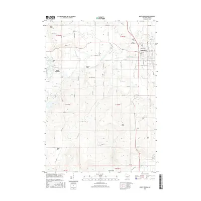
2016 Map of North Freedom
USGS Topo · Published 2016About this map
The Baraboo River winds through this 2016 survey of Sauk County, connecting the village of North Freedom to the western outskirts of Baraboo. The landscape is defined by the elevation changes between the North Range and the South Range, with dramatic local relief seen at Baxters Hollow and Hoot Owl Hollow. For those interested in regional recreation and conservation, the Ice Age National Scenic Trail is clearly delineated as it traverses the eastern ridges near West Baraboo. The map also captures a high density of rural burial sites, including Saint Michaels Cem, Rock Hill Cem, and Sumpter Hill Cem, which are essential markers for local genealogical research. Water features such as Skillet Falls, Seeley Lake, and the Kindschis Spring provide insight into the drainage patterns of this varied terrain.
Find a feature on this map
99 named features on this map. Tap any name to fly to it.
Don’t see what you’re looking for? This feature index may not catch every label — zoom into the map to look around manually.
Map Details
Editions of this 2016 North Freedom Map
This is the sole edition of this map. No revisions or reprints were ever made.
Other maps of this area

1895 · Baraboo
USGS Topo · 1:62,500

1901 · Denzer
USGS Topo · 1:62,500

1901 · The Dells
USGS Topo · 1:62,500

1902 · Briggsville
USGS Topo · 1:62,500

1908 · Baraboo
USGS Topo · 1:62,500

1957 · Wisconsin Dells
USGS Topo · 1:62,500

1957 · Madison
USGS Topo · 1:250,000

1958 · Briggsville
USGS Topo · 1:62,500

1958 · North Freedom
USGS Topo · 1:62,500

1959 · Baraboo
USGS Topo · 1:62,500